AIと衛星データで
農業に革命を起こす
Sagri solves various problems facing agriculture, using image analysis and AI polygon technologies that combine satellite data and AI.
Business事業内容
衛星データとAIを活用し、農業の課題を解決するための事業を展開しています
01
view more
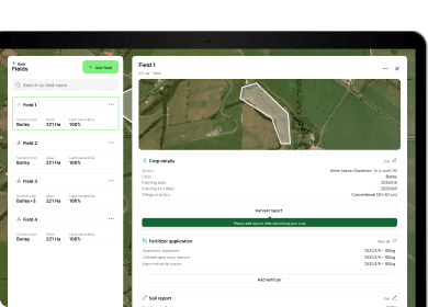
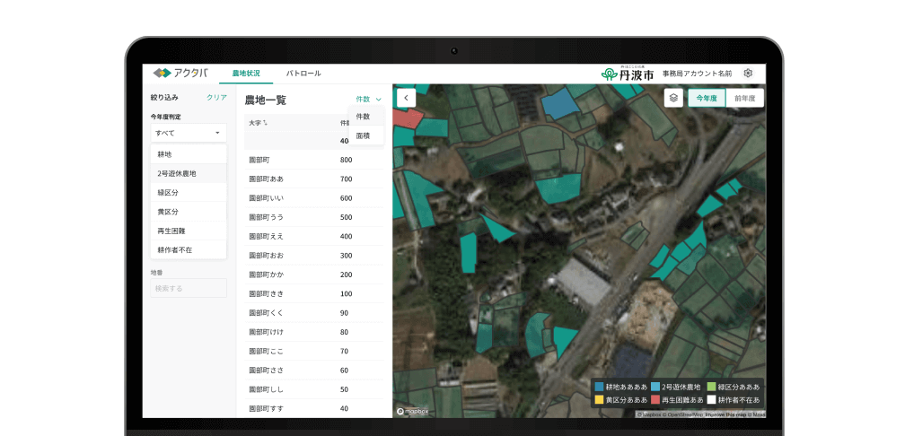
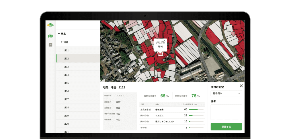
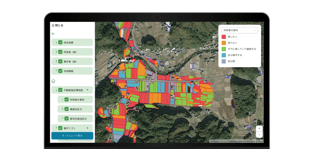
農地活用事業
アクタバ(耕作放棄地の検出)、デタバ(作物分類の推定)、ニナタバ(農地と人をつなぐマッチング)の3つを主たるサービスとして展開。衛星データや土地区画データもとに独自の技術で見える化します。農地がより良い形で活かされ、持続可能な農業の実現や地域社会の活性化を目指しています。
02
view more
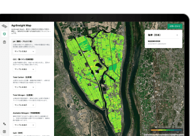
アグリイノベーション事業
農地区画化や土壌の化学性解析技術を用いて環境保全・再生型農業をサポートするサービスを提供しています。SBTi-FLAGに対するGHG排出量・炭素除去量算定、削減・除去活動支援や農業由来のカーボンクレジット事業、脱炭素に繋がる農業資材の活用推進プロジェクト等を行っています。