Revolutionizing Agriculture with AI and Satellite Data
Sagri solves various problems facing agriculture, using image analysis and AI polygon technologies that combine satellite data and AI.

Our vision
Achieving Coexistence of Humanity and the Earth
To create a sustainable society where mankind and the Earth can coexist, and to create a bright future for the next generation, we will continue to face challenges and provide answers.
Business
衛星データとAIを活用し、農業の課題を解決するための事業を展開しています
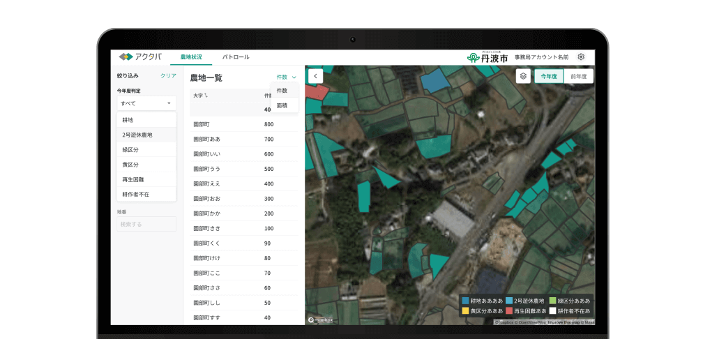
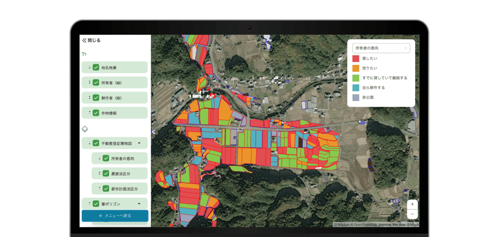
Farmland Utilization
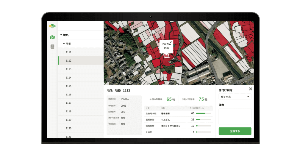
Agri Innovation
News
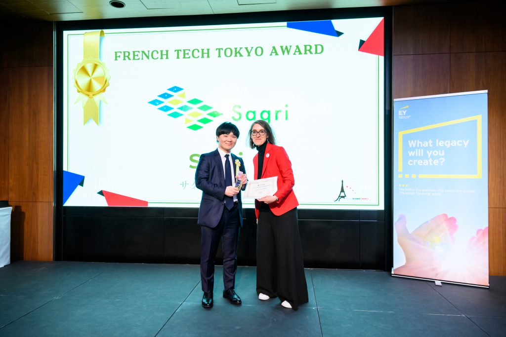

Awards
2024
Prime Minister’s Award at the 6th Space Development and Utilization Grand Prize
2023
Youth Leader at the APEC “BCG (Bio-Circular-Green) Award”
Selected for the “J-Startup Impact” by the Ministry of Economy, Trade, and Industry (METI)
Winner of the "ICC Summit KYOTO 2023 CATAPULT Grand Prix"
Selected for "J-Startup 2023" by the Ministry of Economy, Trade, and Industry (METI)
2022
Runner-up, Nomura Prize, and UPSIDER Prize at "B Dash Camp 2022 FALL in Fukuoka"
2nd Place at the "ICC Summit KYOTO 2022"
Excellence Award in the 4th Term of the "JA Accelerator"
Environmental Startup Initiative Award at the "Environmental Startup Awards" by the Ministry of the Environment
2021
Selected for "J-Startup KANSAI"
2018
Chosen for the "500 KOBE ACCELERATOR Program"
Recruit
We are looking for members who want to work together to solve agricultural problems!
Contact
Please feel free to contact us.