Business- Agri Innovation
New solutions for the agricultural sector using satellite data
We use machine learning to analyze big data in the agricultural field, combining satellite data with field data and other data, and then use the results of the analysis and our knowledge of agricultural science to turn them into solutions.
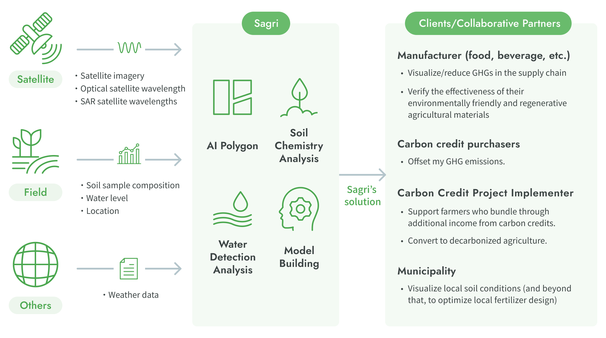
In our Agri-Innovation business, we leverage farmland boundary detection, Digital Soil Mapping (DSM) for soil chemical analysis, and process-based models to promote environmental conservation and regenerative agriculture. Our initiatives include developing agriculture-based carbon credit projects under the VCS, accounting for GHG emissions and removals in alignment with SBTi-FLAG, promoting agricultural inputs that contribute to decarbonization, and visualizing water levels and GHG emissions in paddy fields to support informed decision-making for water management.
Key Projects
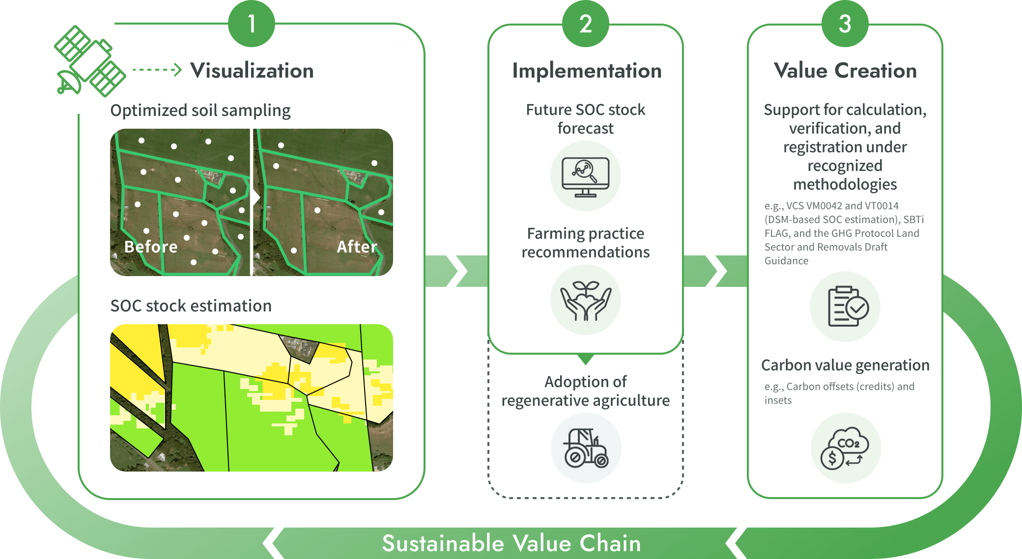
SOC Monitoring for Regenerative Agriculture and MRV-Based Carbon Value Creation
By combining farm management data with Sagri’s technology, we optimize soil sampling and apply Digital Soil Mapping (DSM) and RothC modeling to estimate and forecast soil organic carbon (SOC) stocks. This helps improve soil health, support the transition to regenerative agriculture, and generate carbon value in line with internationally recognized frameworks and methodologies.
*Soil Organic Carbon (SOC): SOC represents the amount of carbon derived from atmospheric CO₂ that is stored in soil. It is a core indicator for evaluating regenerative agriculture, carbon farming, and soil health.

- Target Customers
- Companies with agricultural supply chains(e.g., large-scale agribusinesses, food & beverage companies)
- Recommended Scale
- 5,000 hectares or more
- Requirements
-
- ・Proof of land use: Permission from landowners or managers to implement new practices.
- ・Secured data availability: Ability to provide farming data on demand during the project.
Sagri Water Management Solution
By combining your existing datasets with Sagri’s technology,we enable large-scale visualization of paddy fields—previously difficult to achieve—and support the improvement of water management operations and more advanced decision-making.


- Target Customers
- Irrigation authorities; companies involved in rice production and procurement
- Recommended Scale
- 3,000 ha or more (paddy fields)
Our Products
The above initiatives are powered by our proprietary products.
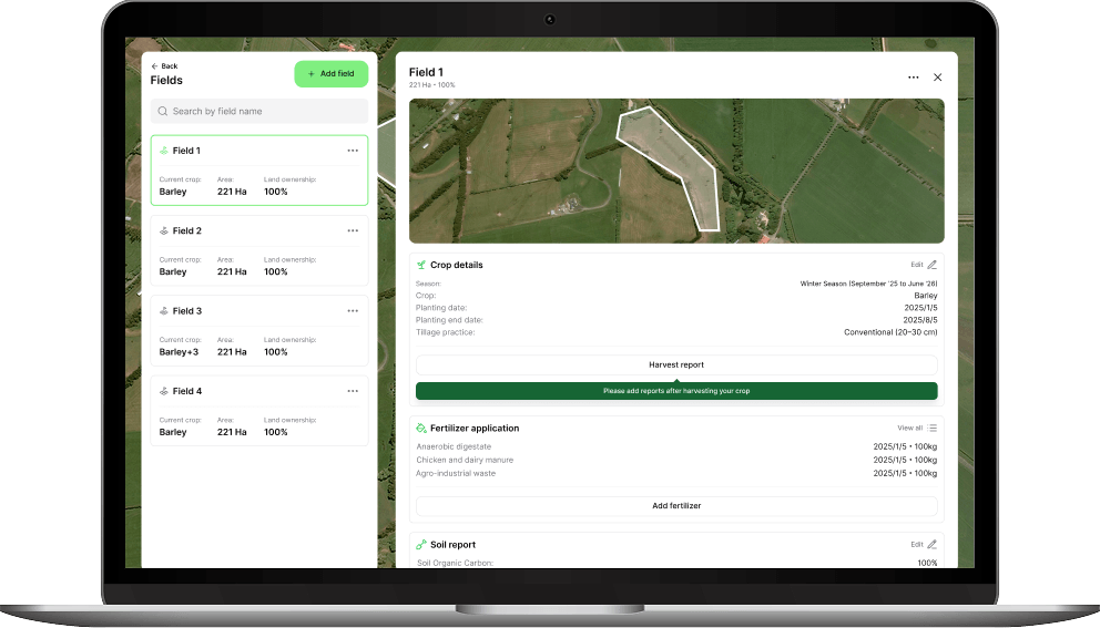
SagriVision
A digital platform designed to simplify complex carbon accounting. With AI polygons for automatic farmland boundary generation and an intuitive UI, users can easily register farming data and complete calculations without specialized knowledge. By automating highly accurate, internationally compliant MRV processes, it drives corporate decarbonization and reduces the operational burden for both businesses and farmers.
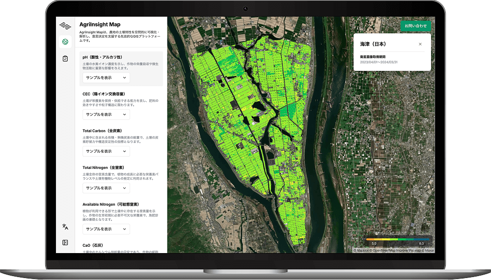
AgriInsight Map
A platform where you can experience Sagri's technology for analyzing farmland. After gaining a deeper understanding of the analysis results and advanced analysis use cases, you can request our services.We support understanding the current state of farmland, improving agricultural productivity, and decarbonizing farmland.
Contact
Please feel free to contact us.