Business- Farmland Utilization
We offer three main services: Actaba (detection of abandoned farmland), Detaba (estimation of crop classification), and Ninataba (matching farmland with people). Utilizing satellite imagery and land parcel data, we visualize agricultural information through proprietary technology. Our mission is to make better use of farmland and contribute to the realization of sustainable agriculture and the revitalization of local communities.
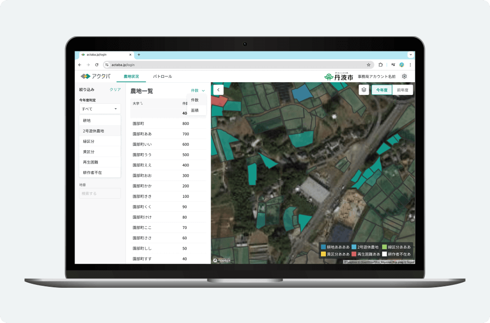
Actaba
For Agricultural Committees
An agricultural land patrol application that detects abandoned land. Patrol personnel can be assigned, and progress and judgment results can be managed. It streamlines the work of checking farmland, which used to be done visually by local governments.
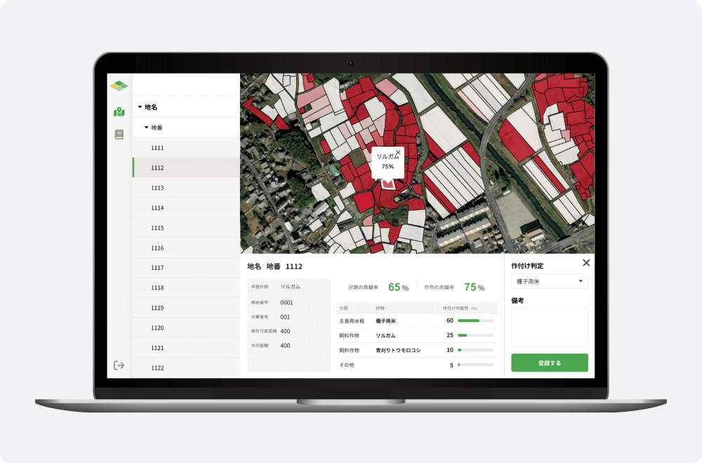
Detaba
For Regional Agricultural Revitalization Councils
An application for cropping surveys that detects crop types. Patrol personnel can be assigned, and progress and judgment results can be managed. It greatly streamlines the work of local governments that visually check the planted crops.
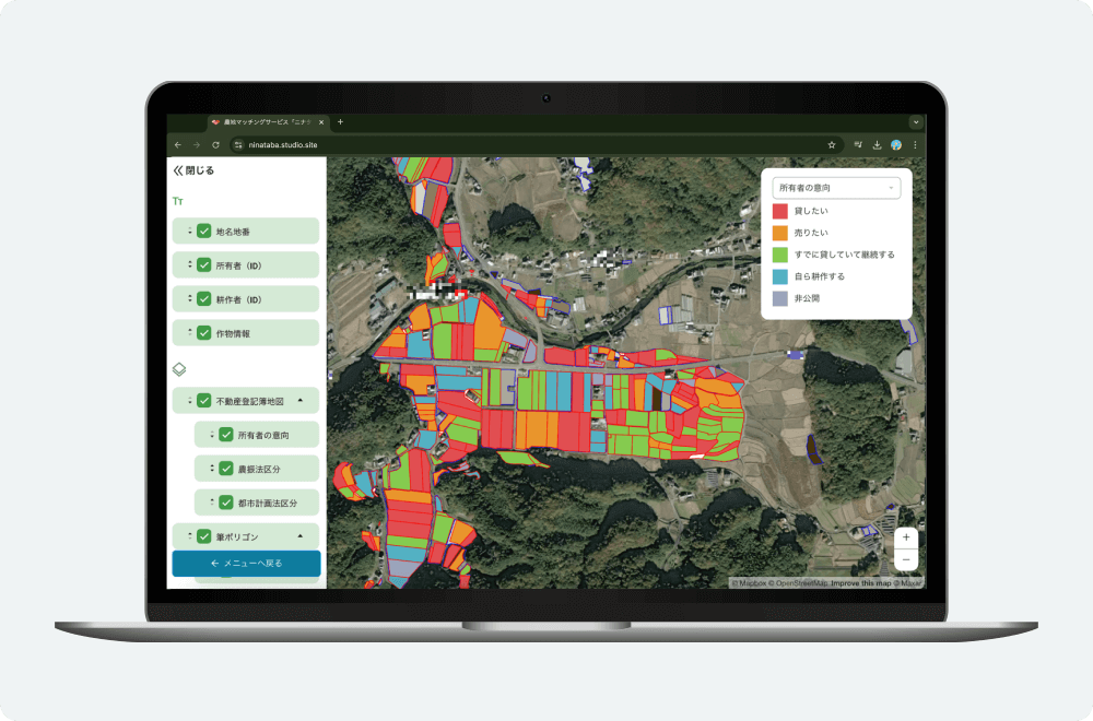
Ninataba
A farmland matching fl-util that connects farmland owners with makers and bearers. Using satellite data analysis and GIS technology, we detect scattered farmland and conduct large-scale planning, primarily matching large-scale farmers with landowners.

Recruit
We are looking for members who want to work together to solve agricultural problems!
Contact
Please feel free to contact us.