
Farmland patrols are time-consuming and labour-intensive.
With ACTABA, abandoned farmland can be identified at a glance.
The man-hours required for visual checks can be drastically reduced.
The app can also be used to prepare for patrols and manage data after the survey.
Visualisation of the cultivation status of farmland.
Challenges for farmland patrols
With ACTABA, it is possible to
Conduct farmland patrols visually
Abandoned farmland is identified by the app and
90% reduction in survey man-hours
apping is required to prepare for patrols
Survey can be carried out with a single tablet
No need to create maps.
Paper ledger records
Manual data input into ledger system
Data can be compiled and output
Registration in the ledger system can be completed in 30 minutes.

FEATURES
Point.1
Abandoned land can be identified.
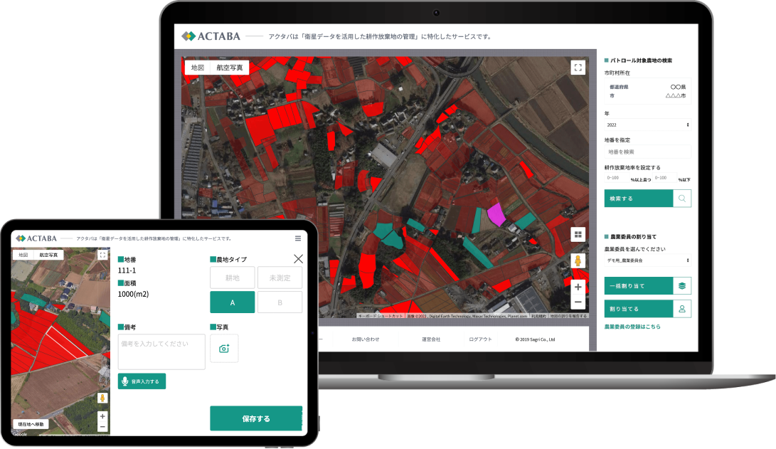
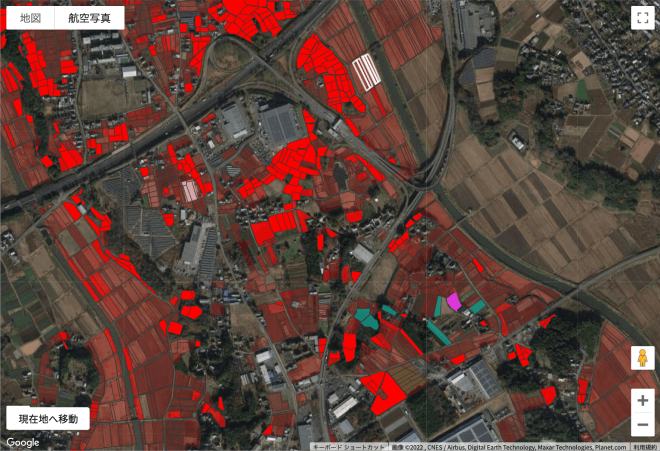
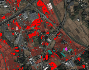
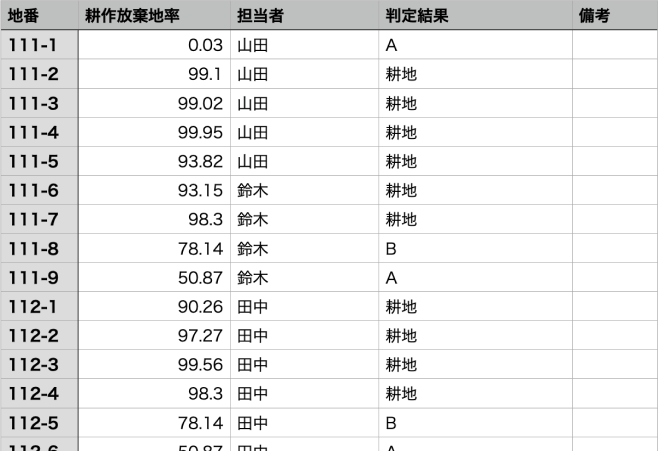
The rate of abandoned farmland is determined based on satellite data and displayed on a map. If field patrols are required, the relevant farmland can be allocated to the person in charge.
Point.2
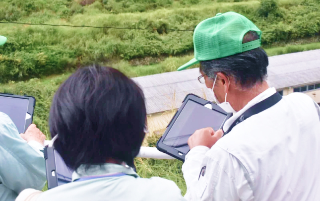
One tablet can be used from survey to registration of results.
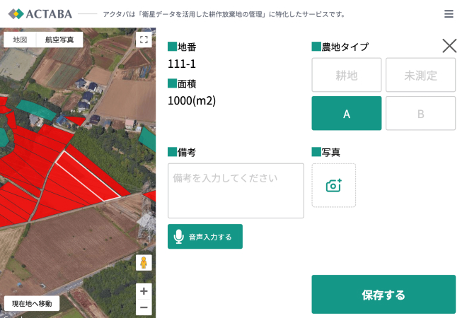
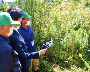
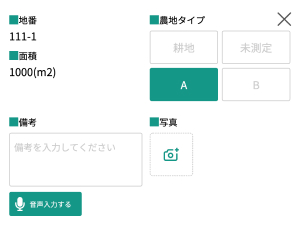
Patrollers can check their allocated farmland on their tablet. They can use the navigation function to go to the farm and register the results of the survey and photographs taken.

Point.3
The judgment result data can be output together.
Data on survey results registered by each person in charge can be managed collectively by the secretariat. The data can be downloaded in CSV format so that the surveyed farmland can be grasped on a map and easily registered in the ledger system.
USER’S VOICE
Work that used to take four days was completed in one and a half days! Significant man-hours saved, allowing the company to focus on more important tasks.
Gifu Prefecture, Gero City Agricultural Committee

The introduction of Actava has enabled agricultural commissioners to save labour and concentrate on their primary tasks (optimising agricultural land use).
Onomichi City Agricultural Committee, Hiroshima Prefecture
HOW IT WORKS
STEP1
Analysis with ACTABA.
Check the rate of abandoned land and identify areas that should be patrolled as a priority.
STEP2
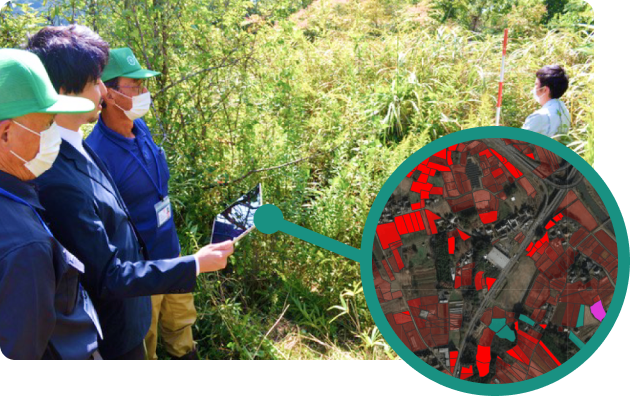
Patrol areas Allocation of patrolling areas to those in charge
The Secretariat allocates farmland to be patrolled to each person in charge. The person in charge can check his/her area of responsibility from his/her tablet.
STEP3
Input of survey results
The person in charge registers the results of the patrols on his/her tablet. Photographs taken can also be registered.
STEP4
Compilation and management of data
The registered information can be managed together by the Secretariat. The data can be downloaded in CSV format for registration in the ledger system.
The registered survey results are learnt by the AI to improve the accuracy of the decision in the next and subsequent surveys.
Would you like to streamline your cropping surveys with ACTABA'?