Instantly visualize the planting status
Detaba is a smart app that estimates crop types and helps municipalities, JA, and Agricultural Revitalization Councils
drastically reduce the workload of on-site confirmation tasks.
With features like real-time location display and easy photo uploads,
even first-time users can conduct smooth and efficient surveys.
Traditional Planting Survey
- Visually inspect each farmland individually.
- Record data in paper ledgers and manually enter it into a computer.
Planting Survey with Detaba
- Instantly identify crop types over large areas of farmland.
- Record data directly on a computer or tablet.
Features
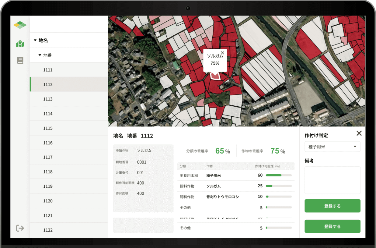
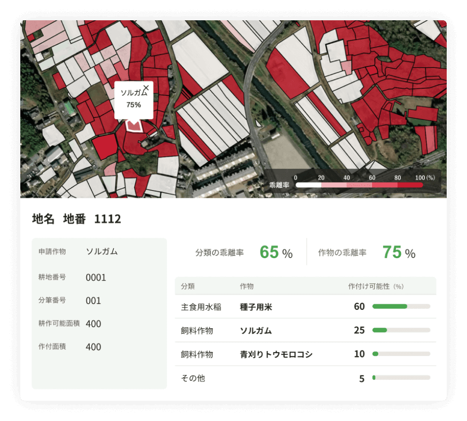
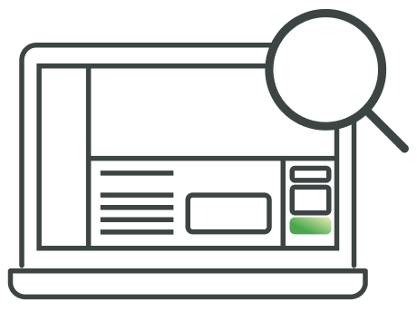
Instantly grasp planting estimation results.
Based on satellite data, the app estimates the crops being planted and displays them. You can easily check if they match the declared crops at a glance.
Visualize paddy field flooding with the Water Index
Using satellite data, a "Water Index"—which correlates with surface water presence—is retrieved and displayed for each farmland plot.During a pre-defined period, Water Index data is regularly updated and added, allowing users to track changes over time.

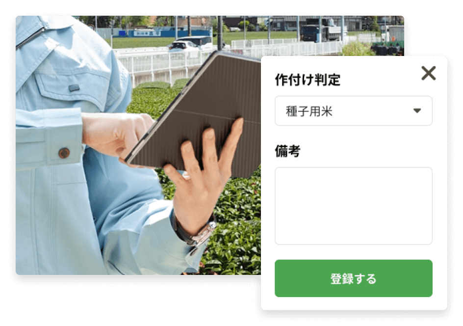
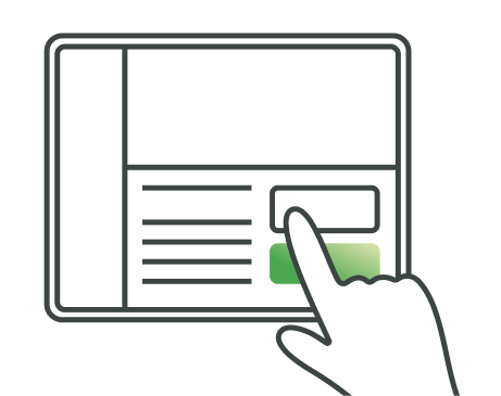
Record cropping assessment results on a tablet
Estimated results can be viewed on a tablet and the device can also be used as an on-site survey tool.Photos can be saved for each field, and the navigation feature enables smooth on-site inspections..
Accuracy
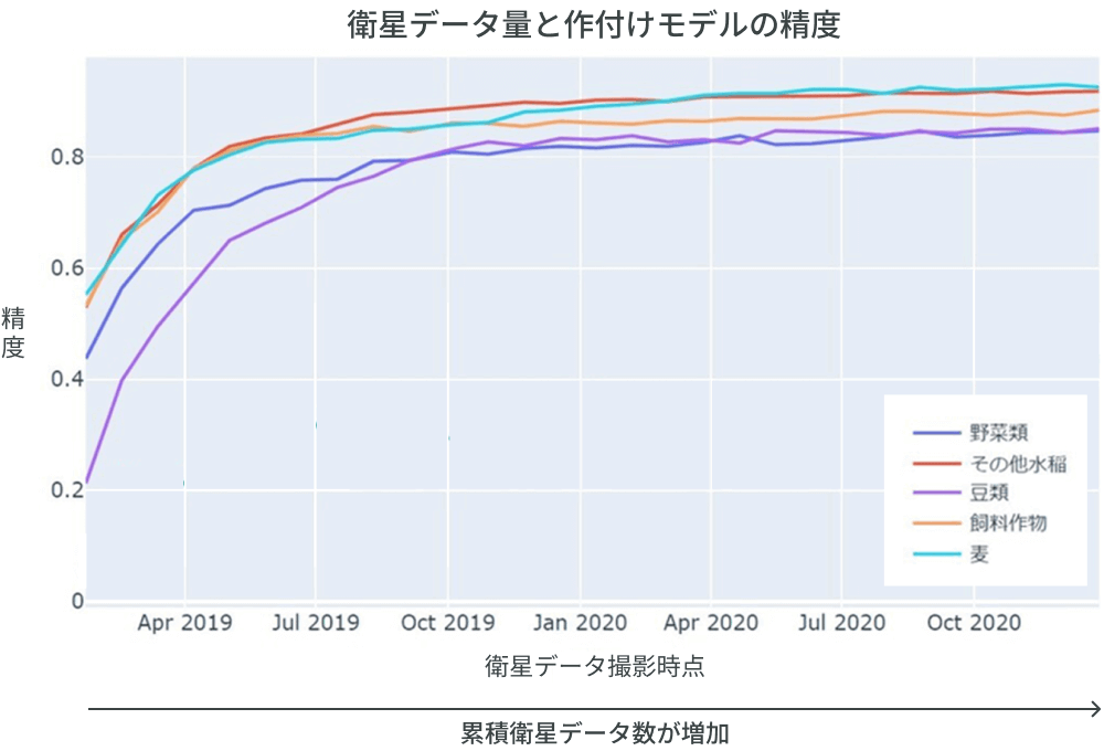
Achieved a highly accurate planting estimation model with over 80% precision at the crop classification level
Developed a model that enables planting surveys through satellite data, allowing for highly accurate crop classification assessments. As the amount of cumulative satellite data increases, the accuracy of the planting estimation model improves.
How to use
Step1
Check Planting Status with Detaba
Use Detaba to verify if the declared crops match the planted crops.
Step2

Conduct On-Site Surveys Only Where Needed
Investigate farmland where declared crops and planted crops do not match, using navigation for guidance.
Step3
Input Assessment Results
Enter assessment results on a computer or tablet.
Step4
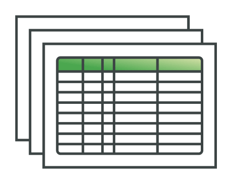
Manage Data Efficiently
Consolidate and output planting-related data* for use in procedures and processes.
*Updates planned for future versions.
Would you like to streamline your planting surveys with Detaba?
To learn more about Detaba
Request documentsFor any questions or if you'd like to have a casual conversation
Contact us