Technology
Satellite×AI×GRID
Currently, a variety of data can be obtained from satellites. However, the utilization of this data is still under development. Sagri will construct algorithms based on the data obtained from satellites and data from the ground to improve agriculture and other human activities on the earth.
Progress of the AI technology
Satellite Data as Big Data
Satellite data is expected to be useful because it can obtain ground data over a wide area and in a homogeneous manner. Since it can also acquire data in the infrared and microwave regions of non-visible light, which are invisible to the human eye, it is being studied for a wide range of applications. At the same time, however, satellite data is limited in resolution (image resolution), and with various types of sensors available, it is difficult for end users to directly utilize the data, so there is a need for players who can provide appropriate data.The history of satellite data is long, starting with the purpose of military use, and has long been utilized for research purposes. Until now, features and changes have been captured visually by analyzing the combination of wavelengths in each sensor or by coloring satellite images according to the analysis results. Many satellites orbit the same location regularly and are capable of capturing time-series changes, so they are so-called "big data," and analysis methods have had limitations up to now.
Let AI learn
AI predicts farmland conditions
We analyze satellite data using AI technology. Satellite data, which are reflected values of wavelengths from each sensor, are converted into useful data by assigning meaning to what conditions on the ground are indicated by those reflected values. In other words, by having AI learn the characteristics of satellite data in various conditions on the ground, we can create conditions that allow AI to make predictions.For example, our "ACTABA" application for monitoring the status of farmland provides a solution to a major agricultural issue in Japan: the increase in abandoned farmland. The developed AI analyzes satellite data and learns whether each field is cultivated or abandoned, thereby capturing the characteristics of the farmland. The algorithm developed by the company provides a prediction of the probability that the land is abandoned.

Utilize of AI/machine learning
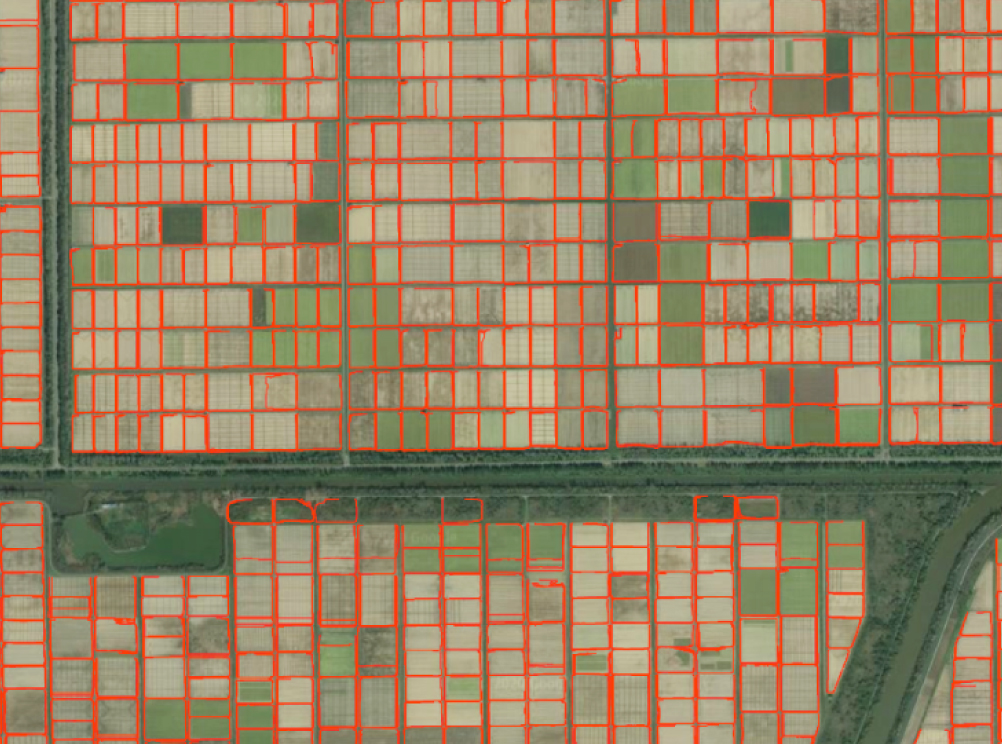
Automatic Polygon Technology for Agricultural Land (Patented Patent No. 7053083)
Our company aims to polygonize farmland around the world by automating the process using AI's image recognition technology, using as teacher data information such as the parcel information (brush polygons) of domestic farmland, which was completed by the Ministry of Agriculture, Forestry and Fisheries in March 2019 and started being provided as open data from April 2019. (Left: Result of actual automated polygon display) The polygons of farmland are also expected to serve as a foundation for holding all kinds of data that will be digitized through smart agriculture, and as an infrastructure for data, it is envisioned that the polygons will be linked to various tools for both hardware and software in smart agriculture.

Recruit
We are looking for members who want to work together to solve agricultural problems!
Contact
Please feel free to contact us.