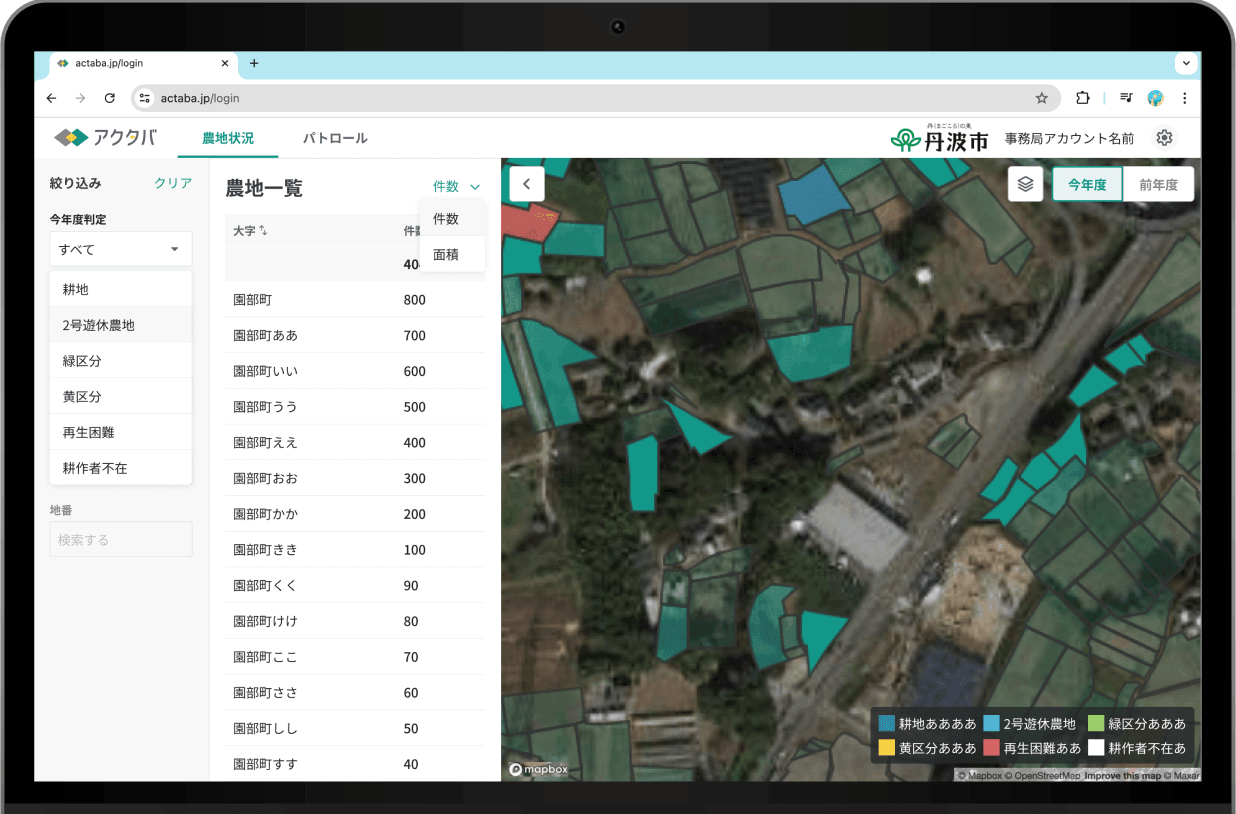
Visualizes the cultivation status of farmland
Quickly grasp the abandonment rate of farmland (*),
even over large areas, and streamline the labor-intensive task of farmland inspections.
You can also manage patrol assignments, progress, and evaluation results.
*A value indicating the likelihood of farmland abandonment, based on AI analysis of satellite data.
Conventional farmland patrol
- Visual inspections required for farmland patrols
- Preparation involves time-consuming map creation
- Manual data entry of paper records into ledger systems
Farmland Patrol by Actaba
- Detect abandoned farmland efficiently with the app, cutting survey workload by 90%
- Perform inspections seamlessly using just a tablet—no map creation needed
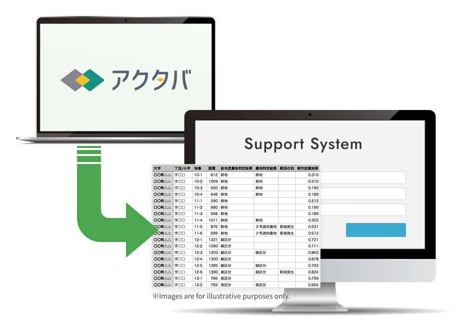
- Export data in bulk and complete ledger system registration in just 30 minutes
Features
Identify Abandoned Farmland
Determine the abandoned farmland rate using satellite data and display it on a map. When on-site patrols are needed, specific farmlands can be assigned to the appropriate personnel.
Optionally, you can partially utilize high-resolution satellite images taken within the past year. For more details, please contact us.
From¥10,000 (excluding tax)

From Inspection to Registration with Just a Tablet
Patrol staff can view their assigned farmland on a tablet. Using the navigation feature, they can travel to the site and register survey results and photos taken on-site.

Bulk updates to the support system are possible using CSV data exported from Actaba
The results of field surveys registered in Actaba are also reflected on the administration side and can be managed synchronously. Surveyed farmland is color-coded and displayed on the map. Exported CSV data can be used to update Agricultural Committee Support Systems and various ledger systems in bulk.
How to use
Step1

Analyze with Actaba
Check the abandoned farmland rate and identify areas that should be prioritized for patrol.
Step2

Assign Patrol Areas to Personnel
The administrative office assigns farmland to be patrolled to each surveyor. Surveyors can confirm their assigned areas via tablet.
Step3

Enter Survey Results
Surveyor register the results of their inspections on the tablet. Photos taken during the patrol can also be uploaded.
Step4

System-wide updates using CSV data
The registered information can be downloaded in CSV format and used for bulk updates to Agricultural Committee Support Systems and ledger systems.
The system learns from registered survey results to improve the accuracy of future evaluations.
Would you like to improve the efficiency of your farmland patrols using Actaba?
High-resolution satellite images are now available.
If you are interested not only in AI analysis but also in satellite imagery, feel free to contact us.
To learn more about Actaba
Request documentsFor any questions or if you'd like to have a casual conversation
Contact us